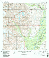
1949 Map of Healy A-6
USGS Topo · Published 1997About this map
The West Fork Chulitna River and the Alaska Railroad corridor form the structural spine of this high-altitude landscape. Based on photogrammetric surveys from 1949, the map reveals the critical intersection of transportation and industry in the Alaska Range. Remote outposts like Honolulu and Hurricane appear as tiny nodes along the rail line, serving as vital links between the interior and the coast. The northern portion of the quadrangle is dominated by the Denali National Park and Preserve and the massive Eldridge Glacier, where the ice and mountains dictate the path of water and people.
Find a feature on this map
34 named features on this map. Tap any name to fly to it.
Don’t see what you’re looking for? This feature index may not catch every label — zoom into the map to look around manually.
Map Details
Editions of this 1949 Healy A-6 Map
5 editions found
Other maps of this area

1949 · Talkeetna Mountains D-6
USGS Topo · 1:63,360

1949 · Healy A-6
USGS Topo · 1:63,360

1950 · Talkeetna Mountains
USGS Topo · 1:250,000

1950 · Talkeetna
USGS Topo · 1:250,000

1950 · Talkeetna Mountains D-5
USGS Topo · 1:63,360

1950 · Healy A-5
USGS Topo · 1:63,360

1950 · Healy B-5
USGS Topo · 1:63,360

1951 · Talkeetna
USGS Topo · 1:250,000

1951 · Healy
USGS Topo · 1:250,000

1951 · Talkeetna Mountains D-5
USGS Topo · 1:63,360