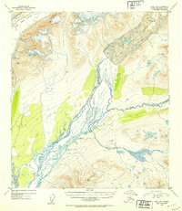
1952 Map of Healy B-1
USGS Topo · Published 1953About this map
The Susitna River dominates this mid-century Alaskan interior landscape, shown here as it appeared in the early 1950s. Flowing from the expansive icy mass of the Susitna Glacier, the river creates a complex braided network through the valley. The map documents a transition from massive ice fields to high-altitude drainage systems, with the West Fork Glacier also contributing significant meltwater to the regional watershed. Local elevation markers provide essential data for this wilderness area, including the survey points at VABM Sitna 5673 and VABM Teddy 6092. These landmarks and the many tributaries like Boulder Creek and the East Fork illustrate the hydrological patterns and high-relief topography characteristic of the Third Judicial Division before significant modern development reached this part of the Alaskan wilderness.
Find a feature on this map
10 named features on this map. Tap any name to fly to it.
Don’t see what you’re looking for? This feature index may not catch every label — zoom into the map to look around manually.
Map Details
Editions of this 1952 Healy B-1 Map
2 editions found

Other maps of this area

1949 · Healy B-2
USGS Topo · 1:63,360

1949 · Healy A-1
USGS Topo · 1:63,360

1950 · Mount Hayes
USGS Topo · 1:250,000

1950 · Healy B-1
USGS Topo · 1:63,360

1950 · Mount Hayes A-6
USGS Topo · 1:63,360

1951 · Healy
USGS Topo · 1:250,000

1951 · Mount Hayes
USGS Topo · 1:250,000

1951 · Mount Hayes B-6
USGS Topo · 1:63,360

1951 · Healy C-1
USGS Topo · 1:63,360

1951 · Healy C-2
USGS Topo · 1:63,360