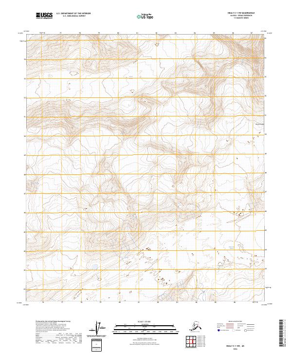
2024 Map of Healy C-1 SW
USGS Topo · Published 2024About this map
Alaska Range peaks dominate the high-altitude topography of this quadrangle, where the glacial landscape is still very much in motion. The northern portion of the map is defined by the Yanert Glacier, while the West Fork Glacier carves through the southeastern terrain. These massive ice features are depicted with detailed contour work that reveals the deep valleys and sharp ridges characteristic of the Denali Borough interior. Absent of any roads or permanent settlements, the map serves as a primary record of the physical geography and hydrological patterns within these high mountain passes, showing the drainage systems that feed from the glacial terminuses into the broader regional watershed.
Find a feature on this map
9 named features on this map. Tap any name to fly to it.
Don’t see what you’re looking for? This feature index may not catch every label — zoom into the map to look around manually.
Map Details
Editions of this 2024 Healy C-1 SW Map
This is the sole edition of this map. No revisions or reprints were ever made.
Other maps of this area

1949 · Healy B-2
USGS Topo · 1:63,360

1950 · Healy B-1
USGS Topo · 1:63,360

1951 · Healy
USGS Topo · 1:250,000

1951 · Healy C-1
USGS Topo · 1:63,360

1951 · Healy C-2
USGS Topo · 1:63,360

1952 · Healy B-1
USGS Topo · 1:63,360

1952 · Healy B-2
USGS Topo · 1:63,360

1956 · Healy
USGS Topo · 1:250,000
2016 · Healy C-1 SW
USGS Topo · 1:25,000
2016 · Healy C-1 SE
USGS Topo · 1:25,000