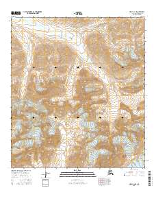
2016 Map of Healy C-2 NE
USGS Topo · Published 2016About this map
Wood River cuts through the northern reaches of this remote interior Alaska landscape, providing a critical drainage through high alpine terrain. This 2016 survey, produced by the U.S. Geological Survey, meticulously documents a region defined by extreme elevation changes and sharp ridgelines, where permanent human settlement is absent and the landscape remains dictated by hydrology and topography. The map spans several townships, including T13s R1w and T14s R1e, illustrating the precise grid of the Public Land Survey System as it overlays this wilderness. For researchers and outdoor explorers, the contour data reveals the complex glacial and fluvial carving that has shaped the drainage basins feeding into the northern river valley.
Find a feature on this map
7 named features on this map. Tap any name to fly to it.
Don’t see what you’re looking for? This feature index may not catch every label — zoom into the map to look around manually.
Map Details
Editions of this 2016 Healy C-2 NE Map
This is the sole edition of this map. No revisions or reprints were ever made.
Other maps of this area

1949 · Healy D-1
USGS Topo · 1:63,360

1951 · Healy
USGS Topo · 1:250,000

1951 · Healy C-1
USGS Topo · 1:63,360

1951 · Healy C-2
USGS Topo · 1:63,360
1951 · Healy D-2
USGS Topo · 1:63,360
1952 · Healy D-1
USGS Topo · 1:63,360
1952 · Healy D-2
USGS Topo · 1:63,360

1956 · Healy
USGS Topo · 1:250,000
2016 · Healy C-1 SW
USGS Topo · 1:25,000
2016 · Healy C-2 NW
USGS Topo · 1:25,000