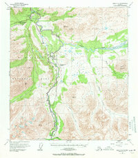
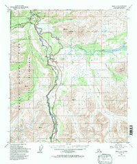
1950 Map of Healy C-4
USGS Topo · Published 1971About this map
Mt McKinley National Park and the rugged interior of Alaska are captured here at the mid-century, centered on the vital transportation corridor formed by the Nenana River and the Alaska Railroad. The map documents the localized development of the era, from the Mt McKinley National Park Headquarters and nearby McKinley Park settlement to the small community at McKinley Village.
Find a feature on this map
32 named features on this map. Tap any name to fly to it.
Don’t see what you’re looking for? This feature index may not catch every label — zoom into the map to look around manually.
Map Details
Editions of this 1950 Healy C-4 Map
6 editions found
Other maps of this area

1949 · Healy B-4
USGS Topo · 1:63,360

1949 · Healy C-3
USGS Topo · 1:63,360

1950 · Healy D-4
USGS Topo · 1:63,360

1950 · Healy C-4
USGS Topo · 1:63,360

1950 · Healy B-3
USGS Topo · 1:63,360

1950 · Healy D-3
USGS Topo · 1:63,360

1950 · Healy B-5
USGS Topo · 1:63,360

1951 · Healy
USGS Topo · 1:250,000

1951 · Healy B-5
USGS Topo · 1:63,360

1951 · Healy B-4
USGS Topo · 1:63,360