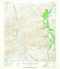
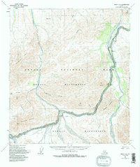
1954 Map of Healy C-6
USGS Topo · Published 1966About this map
Mt McKinley National Park dominates this interior Alaska landscape, mapped during a period when the Denali Highway 16 served as the primary terrestrial artery through these high mountain passes. The survey illustrates the critical water systems of the Teklanika River and the East Fork Toklat River, which carve through the Wyoming Hills and provide the natural corridors for early park infrastructure. Historic locations like the Ranger Cabin near the eastern boundary and the Igloo Creek Campground highlight the mid-century development of visitor access within the park. Notable topographic features such as Sable Pass, Polychrome Pass, and Cathedral Mountain define the high-elevation terrain, showing the relationship between the narrow roadway and the imposing peaks of the Alaska Range before modern rerouting or expansions.
Find a feature on this map
24 named features on this map. Tap any name to fly to it.
Don’t see what you’re looking for? This feature index may not catch every label — zoom into the map to look around manually.
Map Details
Editions of this 1954 Healy C-6 Map
6 editions found

Other maps of this area

1950 · Healy B-5
USGS Topo · 1:63,360

1951 · Healy
USGS Topo · 1:250,000

1951 · Healy B-5
USGS Topo · 1:63,360

1951 · Mount McKinley D-1
USGS Topo · 1:63,360

1951 · Healy D-6
USGS Topo · 1:63,360

1951 · Healy D-5
USGS Topo · 1:63,360

1952 · Healy D-5
USGS Topo · 1:63,360

1952 · Healy C-5
USGS Topo · 1:63,360

1952 · Mount McKinley
USGS Topo · 1:250,000

1952 · Mount McKinley B-1
USGS Topo · 1:63,360