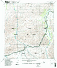
1954 Map of Healy C-6
USGS Topo · Published 1996About this map
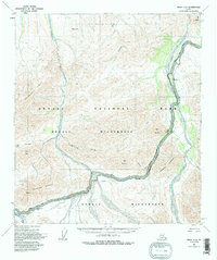
Denali National Park and the expansive Denali Wilderness dominate this mid-century interior Alaskan landscape. The map centers on the glacial river systems and high alpine passes that dictate movement through this subarctic environment. The Denali Park Road serves as the primary artery for travel, winding through notable elevations at Sable Pass and Polychrome Pass. This route provides access to established sites like the Teklanika Campground and Igloo Creek Campground, which were key nodes for visitors and rangers during the early 1950s. The hydrology of the region is defined by the northward flow of the Teklanika River, the East Fork Toklat River, and the Sushana River, which carve through the Wyoming Hills and past peaks such as Igloo Mountain and Cathedral Mountain. The presence of Cabin Divide and Cabin Peak suggests the early infrastructure required for winter patrolling and boundary maintenance in the territory.
Find a feature on this map
24 named features on this map. Tap any name to fly to it.
Don’t see what you’re looking for? This feature index may not catch every label — zoom into the map to look around manually.
Map Details
Editions of this 1954 Healy C-6 Map
6 editions found

Other maps of this area

1950 · Healy B-5
USGS Topo · 1:63,360

1951 · Healy
USGS Topo · 1:250,000

1951 · Healy B-5
USGS Topo · 1:63,360

1951 · Mount McKinley D-1
USGS Topo · 1:63,360

1951 · Healy D-6
USGS Topo · 1:63,360

1951 · Healy D-5
USGS Topo · 1:63,360

1952 · Healy D-5
USGS Topo · 1:63,360

1952 · Healy C-5
USGS Topo · 1:63,360

1952 · Mount McKinley
USGS Topo · 1:250,000

1952 · Mount McKinley B-1
USGS Topo · 1:63,360