
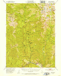
1951 Map of Helena
USGS Topo · Published 1953About this map
The settlement of Helena sits at the southern edge of this mid-century survey, a vital junction where the North Fork and East Fork meet. This reach of the Trinity National Forest is defined by an intensive history of hard-rock prospecting and hydraulic works, evidenced by a dense concentration of mining operations. From the Enterprise Mine and Alaska Mine in the central district to the Ralston Group and Maple Mine further east, the landscape is punctuated by the infrastructure of extraction. Higher elevations are marked by fire suppression history, featuring the Backbone Ridge Lookout and the prominent Weaver Bally Lookout. Former hubs of activity appear as remnants, including Canyon City (Site) and Coleridge (Site), while the interior is dotted with remote outposts like Strunce Cabin and Todd Cabin. The northern reaches transition into the high peaks of the Trinity Alps, where landmarks like Sawtooth Mtn rise above Canyon Creek Lakes.
Find a feature on this map
129 named features on this map. Tap any name to fly to it.
Don’t see what you’re looking for? This feature index may not catch every label — zoom into the map to look around manually.
Map Details
Editions of this 1951 Helena Map
5 editions found
Other maps of this area

1886 · Shasta
USGS Topo · 1:250,000

1890 · Red Bluff
USGS Topo · 1:250,000

1894 · Red Bluff
USGS Topo · 1:250,000

1894 · Shasta
USGS Topo · 1:250,000

1909 · Big Bar
USGS Topo · 1:96,000

1913 · Weaverville
USGS Topo · 1:125,000

1915 · Big Bar and Vicinity
USGS Topo · 1:250,000

1923 · Sawyers Bar
USGS Topo · 1:125,000

1931 · Etna
USGS Topo · 1:96,000

1934 · Etna
USGS Topo · 1:125,000