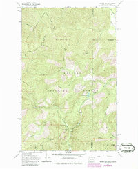
1967 Map of Helmer Mtn
USGS Topo · Published 1986About this map
Roosevelt Grove of Ancient Cedars and the surrounding high-country peaks define this 1967 survey of the border region between Washington and Idaho. The landscape is characterized by its network of watersheds, where Granite Creek flows through the deep Packrat Gorge and over Granite Falls and La Soto Falls. While road access is limited primarily to the southern end near the Stagger Inn Campground, the interior is traversed by an extensive system of a Pack Trail and a Jeep Trail, facilitating movement through the Salmo-Priest Wilderness and the Kaniksu National Forest. The map documents high elevations such as Helmer Mountain and Thunder Mtn, which separate the drainages of Sullivan Cr and Gold Creek. Remote water features like Muskegon Lake and Plaza Lake are situated in steep basins, illustrating the drainage patterns that define the northern Panhandle and Pend Oreille frontier during this era.
Find a feature on this map
43 named features on this map. Tap any name to fly to it.
Don’t see what you’re looking for? This feature index may not catch every label — zoom into the map to look around manually.
Map Details
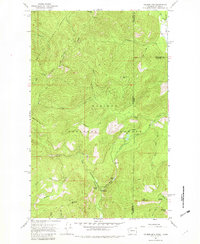
Editions of this 1967 Helmer Mtn Map

Other maps of this area

1911 · Priest Lake
USGS Topo · 1:250,000

1913 · Priest Lake
USGS Topo · 1:250,000

1934 · Metaline
USGS Topo · 1:125,000

1942 · Metaline
USGS Topo · 1:125,000

1958 · Sandpoint
USGS Topo · 1:250,000

1963 · Sandpoint
USGS Topo · 1:250,000

1967 · Gypsy Peak
USGS Topo · 1:24,000

1967 · Salmo Mtn.
USGS Topo · 1:24,000

1967 · Priest Lake NW
USGS Topo · 1:24,000

1967 · Monumental Mtn.
USGS Topo · 1:24,000