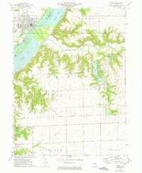
1972 Map of Henry
USGS Topo · Published 1974About this map
The Illinois River serves as the focal point for this survey, dividing the riverside community of Henry from the low-lying wetlands and backwaters to the east. The river's influence is clear in the complex network of adjacent water bodies, including Sawmill Lake, Whitney Lake, and Newhaven Lake, which characterize the floodplain. On the western shore, the town of Henry is shown in detail, featuring its residential grid, a High Sch, and the local Fairground.
Find a feature on this map
34 named features on this map. Tap any name to fly to it.
Don’t see what you’re looking for? This feature index may not catch every label — zoom into the map to look around manually.
Map Details
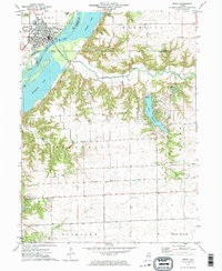
Editions of this 1972 Henry Map
2 editions found
Other maps of this area

1893 · Lacon
USGS Topo · 1:62,500

1893 · Metamora
USGS Topo · 1:62,500

1933 · Lacon
USGS Topo · 1:62,500

1934 · Wenona
USGS Topo · 1:48,000

1937 · Metamora
USGS Topo · 1:62,500

1937 · Lacon
USGS Topo · 1:62,500

1939 · Wenona
USGS Topo · 1:62,500

1948 · Metamora
USGS Topo · 1:62,500

1955 · Minonk
USGS Topo · 1:62,500

1958 · Aurora
USGS Topo · 1:250,000