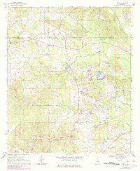
1970 Map of Hero
USGS Topo · Published 1982About this map
Garlandville and the small settlement of Hero serve as the primary hubs in this rural landscape spanning the border of Newton and Jasper Counties. The area is defined by its deep spiritual and community foundations, evidenced by a high density of country churches including Mt Vernon Ch, Bartholomew Ch, and Wesley Chapel. The terrain is drained by numerous winding waterways such as Scotchenflipper Creek and Souenlovie Creek, which create a complex network of ridges and bottoms. This 1970s survey, with early 1980s updates, captures the transition of the local economy through features like the Gravel Pit and Hidden Valley Camp. Genealogists will find significant value in the distribution of family-named landmarks and remote burial sites like Hickory Grove Cem. The presence of the Northside Sch and settlements like Moss Hill reflect the distributed nature of rural Mississippi life before significant modernization changed the local road and rail patterns.
Find a feature on this map
23 named features on this map. Tap any name to fly to it.
Don’t see what you’re looking for? This feature index may not catch every label — zoom into the map to look around manually.
Map Details
Editions of this 1970 Hero Map
2 editions found
Other maps of this area

1953 · Meridian
USGS Topo · 1:250,000

1957 · Meridian
USGS Topo · 1:250,000

1957 · Chunky
USGS Topo · 1:62,500

1957 · Enterprise
USGS Topo · 1:62,500

1965 · Meridian
USGS Topo · 1:250,000

1966 · Hickory
USGS Topo · 1:24,000

1966 · Newton
USGS Topo · 1:24,000

1970 · Paulding
USGS Topo · 1:24,000

1970 · Hero
USGS Topo · 1:24,000
1970 · Montrose North
USGS Topo · 1:24,000