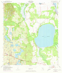
1952 Map of Hesperides
USGS Topo · Published 1973About this map
Lake Rosalie dominates this central Florida landscape, surrounded by a complex network of wetlands and smaller basins such as Saddlebag Lake and Lake Aurora. In the early 1950s, the region maintained a distinctly rural character, with the Seaboard Coast Line railroad providing the primary industrial artery through settlements like Alcoma and Hesperides. The presence of the St Anne Shrine near the southern edge reflects the area's local cultural landmarks, while the Kissimmee River and Lake Hatchineha in the northeast anchor the hydrological system. Development is sparse, concentrated in small clusters like Camp Mack and the residential Tote and Trailer Park areas. Topographic revisions from 1972, shown in purple, highlight evolving land use patterns and canal systems, including those near Buster Island, indicating a shift toward managed water control in the Florida interior.
Find a feature on this map
24 named features on this map. Tap any name to fly to it.
Don’t see what you’re looking for? This feature index may not catch every label — zoom into the map to look around manually.
Map Details
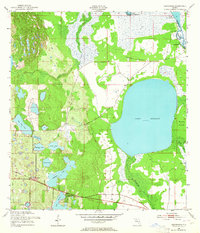
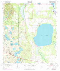
Editions of this 1952 Hesperides Map
4 editions found
Other maps of this area

1952 · Lake Wales
USGS Topo · 1:24,000

1952 · Lake Weohyakapka SE
USGS Topo · 1:24,000

1952 · Lake Weohyakapka NE
USGS Topo · 1:24,000

1952 · Babson Park
USGS Topo · 1:24,000

1952 · Hesperides
USGS Topo · 1:24,000

1952 · Lake Weohyakapka
USGS Topo · 1:24,000

1953 · Cypress Lake
USGS Topo · 1:24,000

1953 · Dundee
USGS Topo · 1:24,000

1953 · Lake Hatchineha
USGS Topo · 1:24,000

1955 · Orlando
USGS Topo · 1:250,000