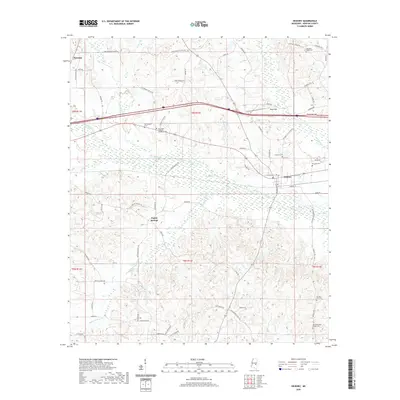
2020 Map of Hickory
USGS Topo · Published 2020About this map
Potterchitto Creek and its complex network of tributaries, including Turkey Creek and Tarlow Creek, dominate this portion of Newton County. The town of Hickory serves as a primary hub, with local roads like West College Street and Hickory Little Rock Road radiating from its center. To the west, the settlement of Poplar Springs sits at the junction of Poplar Springs Road and Brand Road, while the eastern edge of Newton appears in the northwest. The landscape is marked by a significant density of memorial sites, notably the Mississippi Veterans Memorial Cemetery and several family or community burial grounds like Old Norman Cemetery and Ferguson Cemetery. The prevalence of small water bodies like Wickware Pond and named branches such as Bethel Branch indicates a terrain defined by subtle drainage patterns typical of east-central Mississippi.
Find a feature on this map
73 named features on this map. Tap any name to fly to it.
Don’t see what you’re looking for? This feature index may not catch every label — zoom into the map to look around manually.
Map Details
Editions of this 2020 Hickory Map
This is the sole edition of this map. No revisions or reprints were ever made.
Other maps of this area

1953 · Meridian
USGS Topo · 1:250,000

1957 · Meridian
USGS Topo · 1:250,000

1957 · Chunky
USGS Topo · 1:62,500

1957 · Enterprise
USGS Topo · 1:62,500

1965 · Meridian
USGS Topo · 1:250,000

1966 · Hickory
USGS Topo · 1:24,000

1966 · Newton
USGS Topo · 1:24,000

1966 · Decatur NW
USGS Topo · 1:24,000

1966 · Decatur
USGS Topo · 1:24,000

1970 · Hero
USGS Topo · 1:24,000