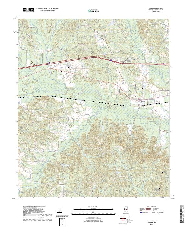
2024 Map of Hickory
USGS Topo · Published 2024About this map
Hickory stands as the primary hub in this eastern Newton County landscape, where the local road network converges near the banks of Potterchitto Creek. The terrain is defined by a dense network of tributaries including Walker Branch, Turkey Creek, and Bogue Falema Creek, which carve through the undulating topography. For genealogists, the map provides a comprehensive record of local burial sites, ranging from the large Mississippi Veterans Memorial Cem Newton to smaller community grounds like Old Norman Cem and Ferguson Cem. The southern reaches of the quadrangle near Poplar Springs reveal a more dispersed settlement pattern, punctuated by landmarks such as Wickware Pond and the Old Good Hope Baptist Cem, illustrating the enduring rural character of the region.
Find a feature on this map
75 named features on this map. Tap any name to fly to it.
Don’t see what you’re looking for? This feature index may not catch every label — zoom into the map to look around manually.
Map Details
Editions of this 2024 Hickory Map
This is the sole edition of this map. No revisions or reprints were ever made.
Other maps of this area

1953 · Meridian
USGS Topo · 1:250,000

1957 · Meridian
USGS Topo · 1:250,000

1957 · Chunky
USGS Topo · 1:62,500

1957 · Enterprise
USGS Topo · 1:62,500

1965 · Meridian
USGS Topo · 1:250,000

1966 · Hickory
USGS Topo · 1:24,000

1966 · Newton
USGS Topo · 1:24,000

1966 · Decatur NW
USGS Topo · 1:24,000

1966 · Decatur
USGS Topo · 1:24,000

1970 · Hero
USGS Topo · 1:24,000