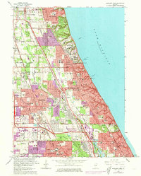
1963 Map of Highland Park
USGS Topo · Published 1973About this map
Fort Sheridan and the Sheridan AAF airfield dominate the Lake Michigan shoreline in this coastal survey, reflecting the area's mid-century military and suburban integration. The corridor between Lake Forest and Glencoe reveals an affluent landscape defined by expansive private grounds like the Onwentsia Club, Old Elm Golf Club, and Exmoor Country Club. Inland, the rapid expansion of Highland Park, Deerfield, and Northbrook is evident, with purple revisions highlighting the growth of residential subdivisions around the Tri-State Tollway and Edens Expressway.
Find a feature on this map
100 named features on this map. Tap any name to fly to it.
Don’t see what you’re looking for? This feature index may not catch every label — zoom into the map to look around manually.
Map Details
Editions of this 1963 Highland Park Map
3 editions found
Other maps of this area

1899 · Evanston
USGS Topo · 1:62,500

1900 · Highwood
USGS Topo · 1:62,500

1906 · Waukegan
USGS Topo · 1:62,500

1908 · Waukegan
USGS Topo · 1:62,500

1927 · Arlington Heights
USGS Topo · 1:24,000

1928 · Wheeling
USGS Topo · 1:24,000

1928 · Highland Park
USGS Topo · 1:24,000

1928 · Evanston
USGS Topo · 1:24,000

1929 · Park Ridge
USGS Topo · 1:24,000

1951 · Highland Park
USGS Topo · 1:24,000