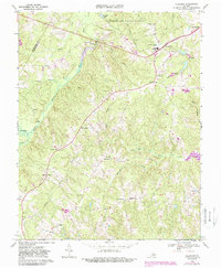
1968 Map of Hillcrest
USGS Topo · Published 1987About this map
Cumberland State Forest anchors the northern portion of this landscape, where the Willis River snakes through central Virginia's Piedmont. The map documents a late-twentieth-century transition, with the 1968 baseline updated in 1987 to show evolving land use. Small crossroads communities and family-named landmarks characterize the settlement pattern, notably Ca Ira and Guinea Mills.
Find a feature on this map
41 named features on this map. Tap any name to fly to it.
Don’t see what you’re looking for? This feature index may not catch every label — zoom into the map to look around manually.
Map Details
Editions of this 1968 Hillcrest Map
4 editions found
Other maps of this area

1891 · Palmyra
USGS Topo · 1:125,000

1891 · Farmville
USGS Topo · 1:125,000

1893 · Farmville
USGS Topo · 1:125,000

1895 · Palmyra
USGS Topo · 1:125,000

1897 · Palmyra
USGS Topo · 1:125,000

1947 · Roanoke
USGS Topo · 1:250,000

1950 · Dillwyn
USGS Topo · 1:62,500

1958 · Farmville
USGS Topo · 1:62,500

1958 · Jetersville
USGS Topo · 1:62,500

1958 · Dillwyn
USGS Topo · 1:62,500