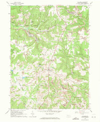
1963 Map of Hilliards
USGS Topo · Published 1971About this map
Extensive strip mining and oil extraction dominate this landscape at the intersection of several northern Butler County townships. The industrial footprint is evident throughout Washington, Parker, Fairview, and Concord townships, where numerous Strip Mines and scattered Oil Wells sit adjacent to rural hamlets. The Bessemer and Lake Erie railroad corridor serves the area, passing through Hilliards and near Argentine, while an old railroad grade traces the former path of industry through the terrain.
Find a feature on this map
35 named features on this map. Tap any name to fly to it.
Don’t see what you’re looking for? This feature index may not catch every label — zoom into the map to look around manually.
Map Details
Editions of this 1963 Hilliards Map
4 editions found
Other maps of this area

1900 · Kittanning
USGS Topo · 1:62,500

1902 · Kittanning
USGS Topo · 1:62,500

1907 · Foxburg
USGS Topo · 1:62,500

1908 · Foxburg
USGS Topo · 1:62,500

1909 · Butler
USGS Topo · 1:62,500

1910 · Hilliards
USGS Topo · 1:62,500

1911 · Butler
USGS Topo · 1:62,500

1912 · Hilliards
USGS Topo · 1:62,500

1944 · Hilliards
USGS Topo · 1:62,500

1953 · Pittsburgh
USGS Topo · 1:250,000