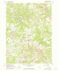
1963 Map of Hilliards
USGS Topo · Published 1973About this map
The Bessemer and Lake Erie Railroad corridors define the transport landscape of northern Butler County, connecting the coal and industrial interests of the mid-20th century. This area is heavily marked by energy extraction, with a dense network of oil wells and numerous strip mines scarring the terrain near Argentine and Hilliards. Despite the industrial footprint, the region maintains its rural social fabric through local landmarks like St Paschals Ch, North Washington Sch, and the community at North Washington.
Find a feature on this map
45 named features on this map. Tap any name to fly to it.
Don’t see what you’re looking for? This feature index may not catch every label — zoom into the map to look around manually.
Map Details
Editions of this 1963 Hilliards Map
4 editions found
Other maps of this area

1900 · Kittanning
USGS Topo · 1:62,500

1902 · Kittanning
USGS Topo · 1:62,500

1907 · Foxburg
USGS Topo · 1:62,500

1908 · Foxburg
USGS Topo · 1:62,500

1909 · Butler
USGS Topo · 1:62,500

1910 · Hilliards
USGS Topo · 1:62,500

1911 · Butler
USGS Topo · 1:62,500

1912 · Hilliards
USGS Topo · 1:62,500

1944 · Hilliards
USGS Topo · 1:62,500

1953 · Pittsburgh
USGS Topo · 1:250,000