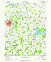
1961 Map of Hillsboro
USGS Topo · Published 1963About this map
The city of Hillsboro serves as the focal point of this Highland County landscape, showing a dense street grid including Main St and High St surrounding the central courthouse. To the east, the waters of Rocky Fork Lake and the adjacent Rocky Fork State Park define the local geography, created by the damming of Rocky Fork. The surrounding townships of Liberty, Washington, Marshall, and Paint are marked by a pattern of rural development centered on small communities like Boston and Berrysville. Local history and genealogy are well-preserved through numerous rural landmarks, including the Mt Washington Ch and several family or community burial grounds such as Kelly Cem and Carlisle Cem. The presence of a Radio Tower, High Sch, and a County home reflects the mid-century infrastructure and social services supporting the region during the early 1960s.
Find a feature on this map
48 named features on this map. Tap any name to fly to it.
Don’t see what you’re looking for? This feature index may not catch every label — zoom into the map to look around manually.
Map Details
Editions of this 1961 Hillsboro Map
4 editions found
Other maps of this area

1915 · Bainbridge
USGS Topo · 1:48,000

1917 · Bainbridge
USGS Topo · 1:62,500

1917 · Greenfield
USGS Topo · 1:62,500

1917 · Hillsboro
USGS Topo · 1:62,500

1917 · Sabina
USGS Topo · 1:62,500

1943 · Sabina
USGS Topo · 1:62,500

1944 · Hillsboro
USGS Topo · 1:62,500

1944 · Greenfield
USGS Topo · 1:62,500

1947 · Columbus
USGS Topo · 1:250,000

1960 · Greenfield
USGS Topo · 1:24,000