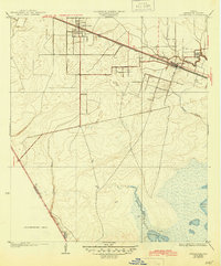
1932 Map of Hitchcock
USGS Topo · Published 1945About this map
Hitchcock and Alta Loma serve as the primary hubs along the Gulf Colorado and Santa Fe railroad in this coastal Texas landscape surveyed just before the 1930s. The map captures a transition from organized town plats and rail-side development to the intricate hydrology of the gulf coast lowlands. A network of tidal waterways, including Highland Bayou, Carancahua Bayou, and Basford Bayou, meander toward the marshy margins of Greens Lake and Carancahua Lake.
Find a feature on this map
14 named features on this map. Tap any name to fly to it.
Don’t see what you’re looking for? This feature index may not catch every label — zoom into the map to look around manually.
Map Details
Editions of this 1932 Hitchcock Map
2 editions found

Other maps of this area

1929 · Dickinson
USGS Topo · 1:24,000

1929 · Karankawa Lake
USGS Topo · 1:24,000

1929 · Algoa
USGS Topo · 1:24,000

1929 · Hitchcock
USGS Topo · 1:24,000

1929 · Virginia Point
USGS Topo · 1:24,000

1929 · Texas City
USGS Topo · 1:24,000

1931 · Lake Como
USGS Topo · 1:24,000

1932 · Algoa
USGS Topo · 1:31,680

1932 · Dickinson
USGS Topo · 1:31,680

1932 · Texas City
USGS Topo · 1:31,680