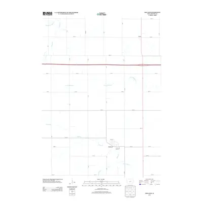
2013 Map of Holland
USGS Topo · Published 2013About this map
Holland serves as the primary municipal center in this section of Grundy County, organized around a traditional grid with streets such as State St and 1st Ave S. The surrounding landscape is defined by the rigid North American rectangular survey system, where a dense network of secondary roads like 180th St and L Ave divide the fertile Iowa prairie into uniform parcels. This agricultural symmetry is broken only by the winding paths of several waterways, including Holland Creek and the S Fork Blackhawk Creek. To the north, the small settlement of Fern sits at a crossroads, illustrating the typical development pattern of rural hamlets supporting the regional farming economy. The drainage patterns of Middle Fork S Beaver Creek and S Beaver Creek in the northwest corner highlight the natural topography that underlies the human-engineered road grid.
Find a feature on this map
32 named features on this map. Tap any name to fly to it.
Don’t see what you’re looking for? This feature index may not catch every label — zoom into the map to look around manually.
Map Details
Editions of this 2013 Holland Map
This is the sole edition of this map. No revisions or reprints were ever made.
Other maps of this area

1954 · Waterloo
USGS Topo · 1:250,000

1955 · Waterloo
USGS Topo · 1:250,000

1971 · Dike
USGS Topo · 1:24,000

1971 · Lincoln
USGS Topo · 1:24,000

1971 · Stout
USGS Topo · 1:24,000

1979 · Grundy Center
USGS Topo · 1:24,000

1979 · Holland
USGS Topo · 1:24,000

1980 · Aplington
USGS Topo · 1:24,000

1980 · Wellsburg
USGS Topo · 1:24,000
1980 · Ivester
USGS Topo · 1:24,000