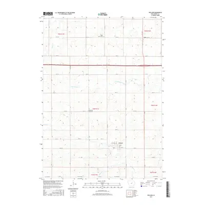
2015 Map of Holland
USGS Topo · Published 2015About this map
Holland and the surrounding rural townships of Grundy County are defined by a grid of agricultural section lines and small creek systems in this 2015 study. The landscape is primarily shaped by the headwaters of Black Hawk Cr and the S Fork Blackhawk Cr, which carve gentle drainages across the prairie. Local heritage is concentrated at significant rural centers such as the Colfax Center Presbyterian Church-Cem and the Pleasant Valley Reformed Cem, providing vital reference points for genealogists tracing family roots in this corner of Iowa. The map also records smaller settlement nodes like Fern and Hoxie, alongside the Holland Cem, illustrating the persistent footprint of early community life amidst contemporary township boundaries like t88n r17w and t89n r16w.
Find a feature on this map
35 named features on this map. Tap any name to fly to it.
Don’t see what you’re looking for? This feature index may not catch every label — zoom into the map to look around manually.
Map Details
Editions of this 2015 Holland Map
This is the sole edition of this map. No revisions or reprints were ever made.
Other maps of this area

1954 · Waterloo
USGS Topo · 1:250,000

1955 · Waterloo
USGS Topo · 1:250,000

1971 · Dike
USGS Topo · 1:24,000

1971 · Lincoln
USGS Topo · 1:24,000

1971 · Stout
USGS Topo · 1:24,000

1979 · Grundy Center
USGS Topo · 1:24,000

1979 · Holland
USGS Topo · 1:24,000

1980 · Aplington
USGS Topo · 1:24,000

1980 · Wellsburg
USGS Topo · 1:24,000
1980 · Ivester
USGS Topo · 1:24,000