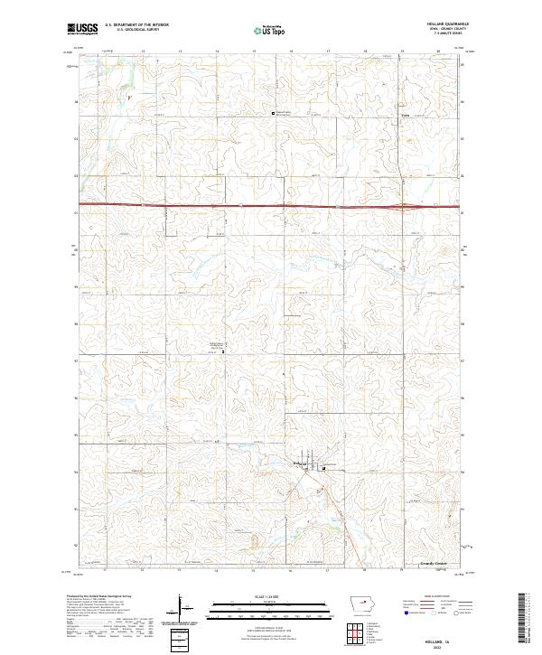
2022 Map of Holland
USGS Topo · Published 2022About this map
Holland sits near the heart of this agricultural landscape in Grundy County, where a grid of section-line roads like Marble Rd and Hoxie Rd defines the prairie layout. The area is marked by a deep-rooted religious and community history, evidenced by landmarks such as the Colfax Center Presbyterian Church Cem and the Pleasant Valley Reformed Cem. These sites, along with the Holland Cem, provide essential anchor points for genealogists tracing families in the townships of T88N R17W and T89N R16W.
Find a feature on this map
37 named features on this map. Tap any name to fly to it.
Don’t see what you’re looking for? This feature index may not catch every label — zoom into the map to look around manually.
Map Details
Editions of this 2022 Holland Map
This is the sole edition of this map. No revisions or reprints were ever made.
Other maps of this area

1954 · Waterloo
USGS Topo · 1:250,000

1955 · Waterloo
USGS Topo · 1:250,000

1971 · Dike
USGS Topo · 1:24,000

1971 · Lincoln
USGS Topo · 1:24,000

1971 · Stout
USGS Topo · 1:24,000

1979 · Grundy Center
USGS Topo · 1:24,000

1979 · Holland
USGS Topo · 1:24,000

1980 · Aplington
USGS Topo · 1:24,000

1980 · Wellsburg
USGS Topo · 1:24,000
1980 · Ivester
USGS Topo · 1:24,000