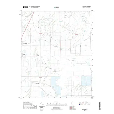
2020 Map of Hollywood
USGS Topo · Published 2020About this map
The Mississippi Delta landscape of northwestern Tunica County is defined by its intricate network of bayous and drainage systems in this 2020 survey. The town of Tunica and nearby North Tunica serve as central hubs, bordered by the sweeping curve of Mud Lake and the Tunica Municipal Airport. The agricultural character of the region is evident in the rectilinear grid of local roads like Beatline Rd and Prichard Rd, which navigate between prominent water features such as Minton Bayou and Jack Lake Bayou.
Find a feature on this map
73 named features on this map. Tap any name to fly to it.
Don’t see what you’re looking for? This feature index may not catch every label — zoom into the map to look around manually.
Map Details
Editions of this 2020 Hollywood Map
This is the sole edition of this map. No revisions or reprints were ever made.
Other maps of this area

1908 · Dundee
USGS Topo · 1:24,000

1908 · Hollywood
USGS Topo · 1:24,000

1908 · Walnut Lake
USGS Topo · 1:24,000

1910 · Dundee
USGS Topo · 1:31,680

1910 · Walnut Lake
USGS Topo · 1:31,680

1913 · Hollywood
USGS Topo · 1:31,680

1931 · Horseshoe Lake
USGS Topo · 1:62,500

1932 · Horn Lake
USGS Topo · 1:48,000

1932 · Crenshaw
USGS Topo · 1:62,500

1935 · Crenshaw
USGS Topo · 1:62,500