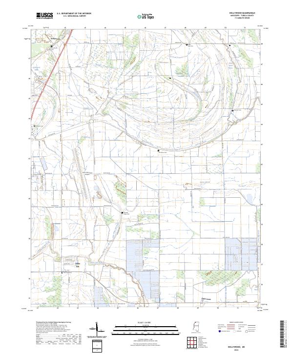
2024 Map of Hollywood
USGS Topo · Published 2024About this map
Hollywood stands at the northern edge of this Tunica County landscape, where the alluvial plain is defined by a dense network of bayous and drainage brakes. The terrain is marked by remnants of former river channels, seen in the winding courses of Minton Bayou and Jack Lake Bayou, alongside larger water bodies like Jasper Lake and Mud Lake. This area reflects a long-established agricultural pattern, with a grid of rural roads such as Prichard Rd and Fish Lake Rd connecting scattered communities and small family cemeteries.
Find a feature on this map
75 named features on this map. Tap any name to fly to it.
Don’t see what you’re looking for? This feature index may not catch every label — zoom into the map to look around manually.
Map Details
Editions of this 2024 Hollywood Map
This is the sole edition of this map. No revisions or reprints were ever made.
Other maps of this area

1908 · Dundee
USGS Topo · 1:24,000

1908 · Hollywood
USGS Topo · 1:24,000

1908 · Walnut Lake
USGS Topo · 1:24,000

1910 · Dundee
USGS Topo · 1:31,680

1910 · Walnut Lake
USGS Topo · 1:31,680

1913 · Hollywood
USGS Topo · 1:31,680

1931 · Horseshoe Lake
USGS Topo · 1:62,500

1932 · Horn Lake
USGS Topo · 1:48,000

1932 · Crenshaw
USGS Topo · 1:62,500

1935 · Crenshaw
USGS Topo · 1:62,500