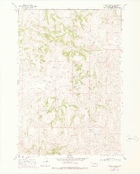
1967 Map of Holmes Ranch
USGS Topo · Published 1978About this map
Holmes Ranch and Porter Ranch serve as the primary human markers in this sparsely populated section of Big Horn County, Montana, as documented in the late 1960s. The landscape is defined by the high, broken terrain of the Badger Hills, where a complex system of drainage basins directs water through various seasonal and perennial channels. The northern reach is shaped by Coal Creek and Corral Creek, while the central portion is dominated by the flow of Deer Creek.
Find a feature on this map
10 named features on this map. Tap any name to fly to it.
Don’t see what you’re looking for? This feature index may not catch every label — zoom into the map to look around manually.
Map Details
Editions of this 1967 Holmes Ranch Map
2 editions found
Other maps of this area

1909 · Sheridan
USGS Topo · 1:125,000

1911 · Sheridan
USGS Topo · 1:125,000

1954 · Hardin
USGS Topo · 1:250,000

1955 · Sheridan
USGS Topo · 1:250,000

1957 · Hardin
USGS Topo · 1:250,000

1958 · Hardin
USGS Topo · 1:250,000

1958 · Sheridan
USGS Topo · 1:250,000

1962 · Sheridan
USGS Topo · 1:250,000

1967 · Holmes Ranch
USGS Topo · 1:24,000

1967 · Tongue River Dam
USGS Topo · 1:24,000