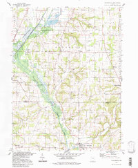
1994 Map of Holmesville
USGS Topo · Published 1998About this map
Killbuck State Wildlife Area dominates the marshy lowlands of the western half of this map, following the winding course of Killbuck Creek. This 1990s update, based on mid-century topographic surveys, captures a rural landscape where small communities like Moreland and Fredericksburg anchor the agricultural uplands. The intersection of local history and industry is evident in the numerous Oil Wells scattered across the Gas Field and the infrastructure of the Pennsylvania Railroad, which parallels an Old Railroad Grade near Holmesville. Genealogists will find significant value in the documentation of family-named landmarks and local burial grounds, including Prairie Cem, West Prairie Cem, and Moorhead Ch. Educational history is preserved through the location of the Franklin Sch, while the terrain is defined by prominent elevations such as Munson Knob and Sterrett Knob.
Find a feature on this map
44 named features on this map. Tap any name to fly to it.
Don’t see what you’re looking for? This feature index may not catch every label — zoom into the map to look around manually.
Map Details
Editions of this 1994 Holmesville Map
2 editions found
Other maps of this area

1901 · Wooster
USGS Topo · 1:62,500

1903 · Wooster
USGS Topo · 1:62,500

1906 · West Salem
USGS Topo · 1:62,500

1908 · West Salem
USGS Topo · 1:62,500

1912 · Loudonville
USGS Topo · 1:62,500

1914 · Loudonville
USGS Topo · 1:62,500

1915 · Millersburg
USGS Topo · 1:62,500

1943 · Millersburg
USGS Topo · 1:62,500

1943 · Loudonville
USGS Topo · 1:62,500

1950 · Marion
USGS Topo · 1:250,000