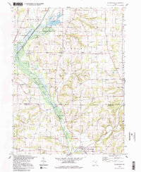
1994 Map of Holmesville
USGS Topo · Published 1998About this map
Killbuck Creek and the surrounding wetlands of the Killbuck State Wildlife Area define the central axis of this landscape at the boundary of Wayne and Holmes counties. The region maintains a distinct agricultural and rural character, anchored by the village of Holmesville in the south and Moreland to the north. Transportation history is visible through the Pennsylvania Railroad corridor and an Old Railroad Grade that cuts through the town of Prairie.
Find a feature on this map
39 named features on this map. Tap any name to fly to it.
Don’t see what you’re looking for? This feature index may not catch every label — zoom into the map to look around manually.
Map Details
Editions of this 1994 Holmesville Map
2 editions found
Other maps of this area

1901 · Wooster
USGS Topo · 1:62,500

1903 · Wooster
USGS Topo · 1:62,500

1906 · West Salem
USGS Topo · 1:62,500

1908 · West Salem
USGS Topo · 1:62,500

1912 · Loudonville
USGS Topo · 1:62,500

1914 · Loudonville
USGS Topo · 1:62,500

1915 · Millersburg
USGS Topo · 1:62,500

1943 · Millersburg
USGS Topo · 1:62,500

1943 · Loudonville
USGS Topo · 1:62,500

1950 · Marion
USGS Topo · 1:250,000