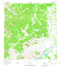
1952 Map of Holy Cross A-4
USGS Topo · Published 1967About this map
Stuyahok Mine and the small settlement of Stuyahok anchor this mid-century survey of the interior Alaskan wilderness. Located in the northern reaches of the Kilbuck Mountains, the landscape is defined by the winding course of the Stuyahok River as it cuts through the upland terrain. The presence of a Landing Strip and a dedicated Winter Trail highlights the remote nature of the region, where seasonal transport and bush aviation were the primary links to the outside world.
Find a feature on this map
8 named features on this map. Tap any name to fly to it.
Don’t see what you’re looking for? This feature index may not catch every label — zoom into the map to look around manually.
Map Details
Editions of this 1952 Holy Cross A-4 Map
3 editions found

Other maps of this area

1947 · Russian Mission
USGS Topo · 1:250,000

1950 · Russian Mission
USGS Topo · 1:250,000

1951 · Holy Cross
USGS Topo · 1:250,000

1951 · Holy Cross A-5
USGS Topo · 1:63,360

1952 · Holy Cross A-4
USGS Topo · 1:63,360

1952 · Holy Cross B-3
USGS Topo · 1:63,360

1952 · Holy Cross B-5
USGS Topo · 1:63,360

1952 · Holy Cross A-3
USGS Topo · 1:63,360

1952 · Holy Cross B-4
USGS Topo · 1:63,360

1952 · Holy Cross
USGS Topo · 1:250,000