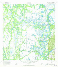
1952 Map of Holy Cross C-2
USGS Topo · Published 1973About this map
The Innoko River winds through a complex network of wetlands and oxbow lakes in this mid-century survey of the Alaska interior. The indigenous settlement of Shageluk sits along the riverbank, serving as a primary point of human activity in an otherwise aqueous landscape dominated by shifting channels and seasonal floodplains. Just north of the village, Shageluk Lake and a series of smaller unnamed water bodies illustrate the alluvial nature of the region, where the land is constantly reshaped by the river's path. Beyond the permanent village, the presence of Cabins and a Winter Trail indicates the seasonal movement patterns essential for trapping and travel in the subarctic. The topography is largely level, though it is anchored by the elevation of Shageluk VABM 927, a rare high point that provides a surveying benchmark for the surrounding drainage basin.
Find a feature on this map
6 named features on this map. Tap any name to fly to it.
Don’t see what you’re looking for? This feature index may not catch every label — zoom into the map to look around manually.
Map Details
Editions of this 1952 Holy Cross C-2 Map
2 editions found
Other maps of this area

1951 · Holy Cross
USGS Topo · 1:250,000

1952 · Holy Cross B-2
USGS Topo · 1:63,360

1952 · Holy Cross C-2
USGS Topo · 1:63,360

1952 · Holy Cross C-1
USGS Topo · 1:63,360

1952 · Holy Cross D-2
USGS Topo · 1:63,360

1952 · Holy Cross B-3
USGS Topo · 1:63,360

1952 · Holy Cross D-3
USGS Topo · 1:63,360

1952 · Holy Cross B-1
USGS Topo · 1:63,360

1952 · Holy Cross D-1
USGS Topo · 1:63,360

1952 · Holy Cross C-3
USGS Topo · 1:63,360