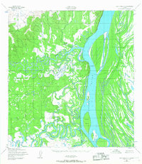
1952 Map of Holy Cross C-3
USGS Topo · Published 1967About this map
Anvik stands at the confluence of the Anvik River and the mighty Yukon River, serving as a focal point in this 1952 Alaskan interior survey. The landscape is defined by the complex, meandering hydraulics of the Bonasila River and several braided channels like Deadmans Slough. This map captures the region's mid-century reliance on river-based transport and seasonal land routes, evidenced by a Landing Strip near the main settlement and a Winter Trail cutting across the eastern wetlands. Significant landmarks such as Hawk Bluff and Slim Island provide essential navigation points for river travel in a territory where the water dictates the patterns of human movement and settlement. Small outposts like Elkhorn further illustrate the sparse but strategically placed habitations along the riverbanks.
Find a feature on this map
13 named features on this map. Tap any name to fly to it.
Don’t see what you’re looking for? This feature index may not catch every label — zoom into the map to look around manually.
Map Details
Editions of this 1952 Holy Cross C-3 Map
2 editions found
Other maps of this area

1951 · Holy Cross
USGS Topo · 1:250,000

1952 · Holy Cross B-2
USGS Topo · 1:63,360

1952 · Holy Cross C-2
USGS Topo · 1:63,360

1952 · Holy Cross D-4
USGS Topo · 1:63,360

1952 · Holy Cross D-2
USGS Topo · 1:63,360

1952 · Holy Cross B-3
USGS Topo · 1:63,360

1952 · Holy Cross D-3
USGS Topo · 1:63,360

1952 · Holy Cross C-3
USGS Topo · 1:63,360

1952 · Holy Cross C-4
USGS Topo · 1:63,360

1952 · Holy Cross B-4
USGS Topo · 1:63,360