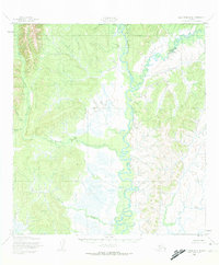
1952 Map of Holy Cross D-4
USGS Topo · Published 1974About this map
Anvik River and Yellow River dominate this interior landscape within the Yukon-Koyukuk region, illustrating a complex network of waterways as they appeared in the early 1950s. The confluence of these rivers and their various tributaries, such as Beaver Creek and Theodore Creek, highlights a terrain defined by shifting drainage patterns and seasonal wetlands. Human presence is sparse and strictly functional, represented by isolated Cabins and a lone Cabin situated along the riverbanks, likely serving as seasonal camps for trapping or subsistence activities. The presence of the North Boundary Seward Meridian running across the map reflects the formal surveying efforts of the Army Map Service during an era of systematic mapping in the Alaskan interior. This survey provides a baseline for understanding the unchanged character of this riverine environment before later environmental or climate-driven shifts in the subarctic landscape.
Find a feature on this map
10 named features on this map. Tap any name to fly to it.
Don’t see what you’re looking for? This feature index may not catch every label — zoom into the map to look around manually.
Map Details
Editions of this 1952 Holy Cross D-4 Map
3 editions found
Other maps of this area

1951 · Unalakleet
USGS Topo · 1:250,000

1951 · Holy Cross
USGS Topo · 1:250,000

1952 · Unalakleet A-4
USGS Topo · 1:63,360

1952 · Unalakleet A-3
USGS Topo · 1:63,360

1952 · Unalakleet A-5
USGS Topo · 1:63,360

1952 · Holy Cross C-5
USGS Topo · 1:63,360

1952 · Holy Cross D-5
USGS Topo · 1:63,360

1952 · Holy Cross D-4
USGS Topo · 1:63,360

1952 · Holy Cross D-3
USGS Topo · 1:63,360

1952 · Holy Cross C-3
USGS Topo · 1:63,360