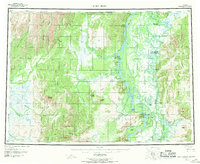
1952 Map of Holy Cross
USGS Topo · Published 1970About this map
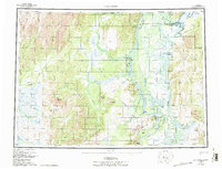
The Yukon River and Innoko River dominate this interior landscape, defining a complex network of sloughs and lakes where water travel remains the primary connection between settlements. During this era of the early 1950s, the importance of aviation in the bush is evident with the Anvik Seaplane Base and Shageluk Seaplane Base serving as vital hubs. Remote outposts like Anvik, Shageluk, and Holy Cross are mapped alongside the curiously named Railroad City on the Innoko.
Find a feature on this map
63 named features on this map. Tap any name to fly to it.
Don’t see what you’re looking for? This feature index may not catch every label — zoom into the map to look around manually.
Map Details
Editions of this 1952 Holy Cross Map
7 editions found

Other maps of this area

1947 · Russian Mission
USGS Topo · 1:250,000

1950 · Russian Mission
USGS Topo · 1:250,000

1950 · Sleetmute
USGS Topo · 1:250,000

1951 · Ophir
USGS Topo · 1:250,000

1951 · Marshall
USGS Topo · 1:250,000

1951 · Unalakleet
USGS Topo · 1:250,000

1951 · St Michael
USGS Topo · 1:250,000

1951 · Holy Cross
USGS Topo · 1:250,000

1951 · Iditarod
USGS Topo · 1:250,000

1951 · Holy Cross A-5
USGS Topo · 1:63,360