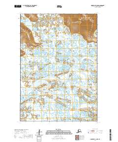
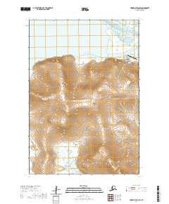
2020 Map of Hooper Bay C-2 NW
USGS Topo · Published 2020About this map
The Askinuk Mountains rise sharply in the northeast corner of this coastal Alaskan landscape, providing a stark topographical contrast to the expansive wetlands that dominate the rest of the terrain. This intricate drainage network is defined by the winding paths of the Kokechik River and Kolomak River, which snake through a mosaic of countless small ponds and marshy lowlands. Further south, the Kwecharak River and the Komoiarak Slough illustrate the complex hydrologic patterns of the Kusilvak region. The absence of roads or permanent settlements emphasizes the wilderness character of the area, where the Kuttak River joins a system of seasonal waterways and shifting channels typical of the Yukon-Kuskokwim Delta's interior reaches.
Find a feature on this map
10 named features on this map. Tap any name to fly to it.
Don’t see what you’re looking for? This feature index may not catch every label — zoom into the map to look around manually.
Map Details
Editions of this 2020 Hooper Bay C-2 NW Map
This is the sole edition of this map. No revisions or reprints were ever made.
Other maps of this area

1951 · Hooper Bay
USGS Topo · 1:250,000

1952 · Hooper Bay C-3
USGS Topo · 1:63,360

1952 · Hooper Bay D-2
USGS Topo · 1:63,360

1953 · Hooper Bay
USGS Topo · 1:250,000

1953 · Hooper Bay C-2
USGS Topo · 1:63,360
1953 · Hooper Bay D-3
USGS Topo · 1:63,360

1964 · Hooper Bay
USGS Topo · 1:250,000
2020 · Hooper Bay C-3 NE
USGS Topo · 1:25,000
2020 · Hooper Bay C-2 NE
USGS Topo · 1:25,000
2020 · Hooper Bay D-2 SW
USGS Topo · 1:25,000