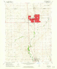
1964 Map of Hoopeston
USGS Topo · Published 1965About this map
The industrial and agricultural hub of Hoopeston serves as the focal point for this mid-1960s survey of eastern Illinois. The town layout is defined by the intersection of the Chicago and Eastern Illinois and the New York Chicago and St Louis railroads, which facilitated its growth as a regional center. Local civic life is well-documented through numerous educational institutions, including Honeywell Sch, Greer Jr High Sch, and Lincoln Sch.
Find a feature on this map
25 named features on this map. Tap any name to fly to it.
Don’t see what you’re looking for? This feature index may not catch every label — zoom into the map to look around manually.
Map Details
Editions of this 1964 Hoopeston Map
This is the sole edition of this map. No revisions or reprints were ever made.
Other maps of this area

1933 · Hoopeston
USGS Topo · 1:48,000

1936 · Potomac
USGS Topo · 1:62,500

1938 · Milford
USGS Topo · 1:48,000

1938 · Hoopeston
USGS Topo · 1:62,500

1939 · Cissna Park
USGS Topo · 1:62,500

1944 · Milford
USGS Topo · 1:62,500

1949 · Cissna Park
USGS Topo · 1:62,500

1953 · Danville
USGS Topo · 1:250,000

1955 · Danville
USGS Topo · 1:250,000

1956 · Danville
USGS Topo · 1:250,000