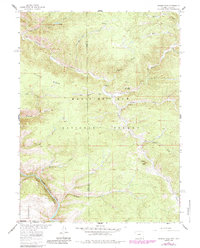
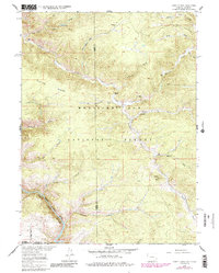
1961 Map of Horatio Rock
USGS Topo · Published 1984About this map
Horatio Rock stands as a prominent landmark in this high-altitude landscape where the Carbon and Albany county line meets the Wyoming-Colorado border. The map illustrates a transitional wilderness managed by the Medicine Bow National Forest, characterized by a complex network of drainage systems like Douglas Creek and Pelton Creek. A historical reliance on pack animals is evident through the naming of the Devils Gate Pack Trail and Hans Creek Pack Trail, which provided access to remote outposts such as Thomson Lodge. The southern portion of the sheet is dominated by the dramatic descent into North Gate Canyon, where the North Platte River cuts through the terrain. Evidence of early recreation and forest management is seen in the established Illinois Creek Campground and Pelton Creek Campground, alongside a lonely Gaging Station monitoring the flow of mountain waters.
Find a feature on this map
32 named features on this map. Tap any name to fly to it.
Don’t see what you’re looking for? This feature index may not catch every label — zoom into the map to look around manually.
Map Details
Editions of this 1961 Horatio Rock Map
5 editions found
Other maps of this area

1906 · Medicine Bow
USGS Topo · 1:125,000

1908 · Medicine Bow
USGS Topo · 1:125,000

1950 · Northgate
USGS Topo · 1:24,000

1950 · Kings Canyon
USGS Topo · 1:24,000

1952 · Northgate
USGS Topo · 1:24,000

1952 · Kings Canyon
USGS Topo · 1:24,000

1954 · Rawlins
USGS Topo · 1:250,000

1954 · Craig
USGS Topo · 1:250,000

1955 · Independence Mountain
USGS Topo · 1:24,000

1955 · Kings Canyon
USGS Topo · 1:62,500