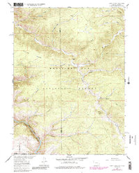
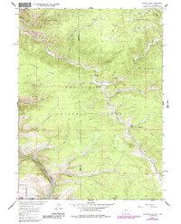
1961 Map of Horatio Rock
USGS Topo · Published 1984About this map
Thomson Lodge stands near the northern boundary of this high-elevation wilderness, where the Carbon and Albany county lines meet. The landscape is defined by the deep incisions of the Platte River as it flows through North Gate Canyon, bordered by the prominent Platte Ridge. This 1960s survey, with updates from the early 1980s, details a rugged backcountry within the Medicine Bow National Forest primarily accessed by a network of Pack Trails.
Find a feature on this map
34 named features on this map. Tap any name to fly to it.
Don’t see what you’re looking for? This feature index may not catch every label — zoom into the map to look around manually.
Map Details
Editions of this 1961 Horatio Rock Map
5 editions found
Other maps of this area

1906 · Medicine Bow
USGS Topo · 1:125,000

1908 · Medicine Bow
USGS Topo · 1:125,000

1950 · Northgate
USGS Topo · 1:24,000

1950 · Kings Canyon
USGS Topo · 1:24,000

1952 · Northgate
USGS Topo · 1:24,000

1952 · Kings Canyon
USGS Topo · 1:24,000

1954 · Rawlins
USGS Topo · 1:250,000

1954 · Craig
USGS Topo · 1:250,000

1955 · Independence Mountain
USGS Topo · 1:24,000

1955 · Kings Canyon
USGS Topo · 1:62,500