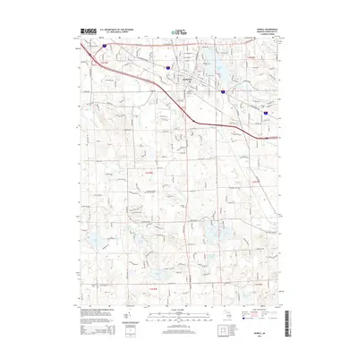
2014 Map of Howell
USGS Topo · Published 2014About this map
Howell serves as the focal point of this Livingston County survey, situated at a significant transit junction where the Howell Station and major thoroughfares like W Grand River Ave meet. The town is surrounded by a dense network of water bodies, including Thompson Lake to the north and a cluster of southern lakes such as Coon Lake, Triangle Lake, and Pleasant Lake. The landscape is defined by the winding paths of the S Br Shiawassee River and the Red Cedar River, which drain the surrounding agricultural and residential lands.
Find a feature on this map
68 named features on this map. Tap any name to fly to it.
Don’t see what you’re looking for? This feature index may not catch every label — zoom into the map to look around manually.
Map Details
Editions of this 2014 Howell Map
This is the sole edition of this map. No revisions or reprints were ever made.
Other maps of this area

1902 · Dexter
USGS Topo · 1:62,500

1904 · Ann Arbor
USGS Topo · 1:125,000

1906 · Dexter
USGS Topo · 1:62,500

1907 · Howell
USGS Topo · 1:62,500

1908 · Ann Arbor
USGS Topo · 1:125,000

1908 · Fowlerville
USGS Topo · 1:62,500

1909 · Howell
USGS Topo · 1:62,500

1910 · Fowlerville
USGS Topo · 1:62,500

1919 · Stockbridge
USGS Topo · 1:62,500

1922 · Stockbridge
USGS Topo · 1:62,500