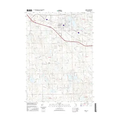
2017 Map of Howell
USGS Topo · Published 2017About this map
Howell serves as the focal point of this Livingston County landscape, situated at the confluence of major regional arteries like W Grand River Ave and W Highland Rd. The city wraps around the southern shores of Thompson Lake, where Mount Olivet Cem and Lakeside Cem occupy prominent positions. The terrain to the south is defined by a dense network of glacial lakes and wetlands, including Triangle Lake, Coon Lake, and Pardee Lake, which drain through the S Br Shiawassee River and the Red Cedar River. For those researching local heritage, several small burial grounds are marked across the townships, such as the Livingston County Poor Farm Cem and Drew Cem. Modern residential developments are seen expanding along corridors like Black Eagle Ridge, yet the area retains its hydrological character with features like Spruce Swamp and Cranberry Lake still clearly delineated.
Find a feature on this map
100 named features on this map. Tap any name to fly to it.
Don’t see what you’re looking for? This feature index may not catch every label — zoom into the map to look around manually.
Map Details
Editions of this 2017 Howell Map
This is the sole edition of this map. No revisions or reprints were ever made.
Other maps of this area

1902 · Dexter
USGS Topo · 1:62,500

1904 · Ann Arbor
USGS Topo · 1:125,000

1906 · Dexter
USGS Topo · 1:62,500

1907 · Howell
USGS Topo · 1:62,500

1908 · Ann Arbor
USGS Topo · 1:125,000

1908 · Fowlerville
USGS Topo · 1:62,500

1909 · Howell
USGS Topo · 1:62,500

1910 · Fowlerville
USGS Topo · 1:62,500

1919 · Stockbridge
USGS Topo · 1:62,500

1922 · Stockbridge
USGS Topo · 1:62,500