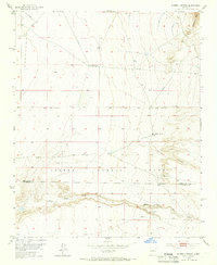
1952 Map of Hubbell Spring
USGS Topo · Published 1966About this map
The Isleta Pueblo Grant dominates this 1952 landscape, where the high desert terrain of the Manzano Mts meets the open rangeland of the Rio Grande valley. This era of land use is defined by isolated outposts like the Mc Cormick Ranch and essential water sources such as Hubbell Spring and Ojo de la Cabra. The survey documents a critical transition between the rugged eastern slopes and the more level plains, marked by a lonely Windmill and a Radio Range Sta that served mid-century aviation. Toward the south, Hells Canyon Wash cuts a deep path through the terrain near a small Cem, providing a window into the sparse settlement patterns along the Bernalillo Co Valencia Co border before modern development arrived.
Find a feature on this map
13 named features on this map. Tap any name to fly to it.
Don’t see what you’re looking for? This feature index may not catch every label — zoom into the map to look around manually.
Map Details
Editions of this 1952 Hubbell Spring Map
4 editions found
Other maps of this area

1888 · Bernalillo
USGS Topo · 1:125,000

1889 · Albuquerque
USGS Topo · 1:125,000

1892 · San Pedro
USGS Topo · 1:125,000

1893 · Albuquerque
USGS Topo · 1:125,000

1917 · Estancia
USGS Topo · 1:125,000

1934 · West Albuquerque
USGS Topo · 1:24,000

1934 · East Albuquerque
USGS Topo · 1:24,000

1938 · Albuquerque
USGS Topo · 1:62,500

1952 · Hubbell Spring
USGS Topo · 1:24,000

1952 · Los Lunas SE
USGS Topo · 1:24,000