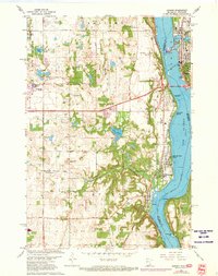
1967 Map of Hudson
USGS Topo · Published 1973About this map
The St Croix River serves as a major geographical and political boundary here, separating the growing settlements of Washington County, Minnesota, from St Croix County, Wisconsin. In the late 1960s, this riverfront corridor saw concentrated development in towns like Hudson, Lakeland, and North Hudson, while the interior of West Lakeland remained a patchwork of orchards and fields. Local history is anchored by spiritual and community landmarks such as St Peters Ch and St Lucas Ch, alongside the preserved Bissels Mounds which reflect a much older human presence on the land.
Find a feature on this map
53 named features on this map. Tap any name to fly to it.
Don’t see what you’re looking for? This feature index may not catch every label — zoom into the map to look around manually.
Map Details
Editions of this 1967 Hudson Map
4 editions found
Other maps of this area

1946 · Hudson
USGS Topo · 1:62,500

1946 · River Falls
USGS Topo · 1:62,500

1948 · New Richmond
USGS Topo · 1:62,500

1948 · Stillwater
USGS Topo · 1:62,500

1949 · New Richmond
USGS Topo · 1:62,500

1949 · River Falls
USGS Topo · 1:62,500

1949 · Hudson
USGS Topo · 1:62,500

1949 · Stillwater
USGS Topo · 1:62,500

1949 · Lake Elmo
USGS Topo · 1:24,000

1949 · Hudson
USGS Topo · 1:24,000