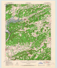
1948 Map of Hulbert
USGS Topo · Published 1967About this map
Hulbert stands as a central hub in this late 1940s landscape, positioned just east of the emerging Fort Gibson Reservoir. The map documents a period of significant transition as the Neosho River valley prepares for inundation, with the reservoir marked as under construction. To the south, the extensive Camp Gruber Military Reservation dominates the terrain, while the St Louis-San Francisco RR provides the primary industrial artery through the region.
Find a feature on this map
107 named features on this map. Tap any name to fly to it.
Don’t see what you’re looking for? This feature index may not catch every label — zoom into the map to look around manually.
Map Details
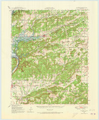
Editions of this 1948 Hulbert Map
3 editions found

Other maps of this area

1896 · Pryor
USGS Topo · 1:125,000

1898 · Tahlequah
USGS Topo · 1:125,000

1899 · Siloam Springs
USGS Topo · 1:125,000

1901 · Muscogee
USGS Topo · 1:125,000

1901 · Pryor
USGS Topo · 1:125,000

1901 · Tahlequah
USGS Topo · 1:125,000

1903 · Siloam Springs
USGS Topo · 1:125,000

1904 · Siloam Springs
USGS Topo · 1:125,000

1905 · Muscogee
USGS Topo · 1:125,000

1905 · Tahlequah
USGS Topo · 1:125,000