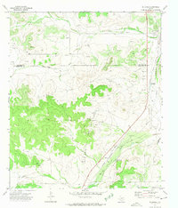
1972 Map of Hulldale
USGS Topo · Published 1974About this map
The Atchison Topeka and Santa Fe Railway cuts a diagonal path across this West Texas landscape, serving as the primary corridor for the Hulldale settlement. The region is defined by its industrial activity, notably the Neva West Oil and Gas Field which spans the central terrain, supported by a Refinery and Pumping Sta located near the tracks. Water management and natural drainage are critical in this arid environment, evidenced by the winding courses of Bois D'Arc Draw and Indian Draw, as well as the significant South Concho River. Local landmarks like Hackberry Waterhole and Tenmile Waterhole provide specific points of interest for those studying the historical geography of the Tom Green and Schleicher county line, where the high ground of Big Hill overlooks numerous gravel operations and utility infrastructure.
Find a feature on this map
15 named features on this map. Tap any name to fly to it.
Don’t see what you’re looking for? This feature index may not catch every label — zoom into the map to look around manually.
Map Details
Editions of this 1972 Hulldale Map
2 editions found
Other maps of this area

1892 · San Angelo
USGS Topo · 1:125,000

1893 · Fort McKavett
USGS Topo · 1:125,000

1895 · Sherwood
USGS Topo · 1:125,000

1954 · Sonora
USGS Topo · 1:250,000

1954 · San Angelo
USGS Topo · 1:250,000

1958 · Sonora
USGS Topo · 1:250,000

1958 · San Angelo
USGS Topo · 1:250,000

1963 · Adams NW
USGS Topo · 1:24,000

1964 · Eldorado NW
USGS Topo · 1:24,000
1964 · Eldorado NE
USGS Topo · 1:24,000