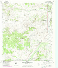
1972 Map of Hulldale
USGS Topo · Published 1988About this map
The Hulldale vicinity in west Texas is defined by the heavy footprint of the petroleum industry, where the Neva West And Gas Field and HJ Oil And Gas Field dominate the landscape. In the early 1970s, this area of the Edwards Plateau was crisscrossed by a network of energy infrastructure, including a Pumping Sta, a Substa, and a Refinery. The natural drainage of Bois D'Arc Draw and Indian Draw cuts through the terrain toward the South Concho River, while landmarks like Big Hill provide topographic contrast.
Find a feature on this map
17 named features on this map. Tap any name to fly to it.
Don’t see what you’re looking for? This feature index may not catch every label — zoom into the map to look around manually.
Map Details
Editions of this 1972 Hulldale Map
2 editions found
Other maps of this area

1892 · San Angelo
USGS Topo · 1:125,000

1893 · Fort McKavett
USGS Topo · 1:125,000

1895 · Sherwood
USGS Topo · 1:125,000

1954 · Sonora
USGS Topo · 1:250,000

1954 · San Angelo
USGS Topo · 1:250,000

1958 · Sonora
USGS Topo · 1:250,000

1958 · San Angelo
USGS Topo · 1:250,000

1963 · Adams NW
USGS Topo · 1:24,000

1964 · Eldorado NW
USGS Topo · 1:24,000
1964 · Eldorado NE
USGS Topo · 1:24,000