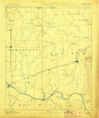
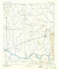
1892 Map of Huntsville
USGS Topo · Published 1907About this map
Huntsville and Athens serve as the primary hubs on this survey of Northern Alabama, conducted before the landscape was transformed by modern development. The map details a region defined by its rail-and-river economy, where the Tennessee River winds along the southern border, crossed by numerous ferries such as those at Draper and Leman. A distinct ridge system to the east is crowned by the Monte Sano Hotel, a notable resort destination of the late nineteenth century.
Find a feature on this map
95 named features on this map. Tap any name to fly to it.
Don’t see what you’re looking for? This feature index may not catch every label — zoom into the map to look around manually.
Map Details
Editions of this 1892 Huntsville Map
6 editions found
Other maps of this area

1885 · Gadsden
USGS Topo · 1:125,000

1888 · Cullman
USGS Topo · 1:125,000

1888 · Gadsden
USGS Topo · 1:125,000

1888 · Scottsboro
USGS Topo · 1:125,000

1888 · Huntsville
USGS Topo · 1:125,000

1892 · Cullman
USGS Topo · 1:125,000

1892 · Huntsville
USGS Topo · 1:125,000

1892 · Scottsboro
USGS Topo · 1:125,000

1892 · Gadsden
USGS Topo · 1:125,000

1895 · Gadsden
USGS Topo · 1:125,000