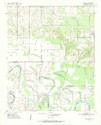
1951 Map of Idabel SE
USGS Topo · Published 1951About this map
The Red River floodplain along the Oklahoma and Texas border defines this 1951 landscape, where the shifting river channel has created an intricate network of oxbow lakes and sloughs. Features such as Eagle Bend Cut-off, Forty-one Cut-off, and Dead Man Lake illustrate the dynamic nature of the waterway separating McCurtain County from Red River County. The rural social fabric is visible through numerous community landmarks, including the Idabel Separate Sch, Macedonian Ch, and Spencer Chapel. In the northern portion, the St Louis San Francisco railroad provides a heavy industrial link, while the landscape rises toward Marshall Hill. This era of documentation reveals a high density of local schools like Richland Sch and St Mark Sch, many of which served as the primary gathering points for the surrounding agricultural families.
Find a feature on this map
42 named features on this map. Tap any name to fly to it.
Don’t see what you’re looking for? This feature index may not catch every label — zoom into the map to look around manually.
Map Details
Editions of this 1951 Idabel SE Map
2 editions found
Other maps of this area

1950 · Idabel
USGS Topo · 1:24,000

1950 · Acworth
USGS Topo · 1:24,000

1950 · De Kalb NW
USGS Topo · 1:24,000

1950 · White Rock
USGS Topo · 1:24,000

1950 · Shults
USGS Topo · 1:24,000

1950 · Haworth
USGS Topo · 1:24,000

1951 · Idabel
USGS Topo · 1:24,000

1951 · Garvin
USGS Topo · 1:24,000

1951 · Idabel SE
USGS Topo · 1:24,000

1951 · English
USGS Topo · 1:24,000