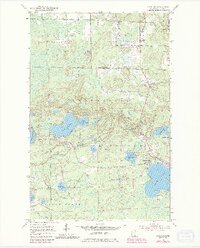
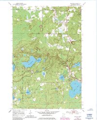
1952 Map of Idington
USGS Topo · Published 1985About this map
Idington Station and the nearby Idington settlement anchor the northern reaches of this St. Louis County landscape, where the Duluth Winnipeg and Pacific railroad cuts through the timberlands. The area is defined by its transition between the George Washington State Forest and the Superior National Forest, a terrain characterized by an intricate network of glacial lakes and wetlands. Prominent water bodies like Lake Fourteen and the expansive Sand Lake dominate the southern half of the quadrangle, connected by drainage systems like Johnson Creek and the Rice River. Cultural landmarks such as the Sand Lake Chapel and the Idington Cem provide specific points of interest for genealogists, while the Birch Knob Lookout Tower stands as a sentinel over the surrounding forest. The map also records early industrial and municipal markers, including a Gravel Pit and the local Town Hall.
Find a feature on this map
35 named features on this map. Tap any name to fly to it.
Don’t see what you’re looking for? This feature index may not catch every label — zoom into the map to look around manually.
Map Details
Editions of this 1952 Idington Map
6 editions found
Other maps of this area

1951 · Virginia
USGS Topo · 1:24,000

1951 · Kinney
USGS Topo · 1:24,000

1951 · Britt
USGS Topo · 1:24,000

1952 · Idington
USGS Topo · 1:24,000

1954 · Hibbing
USGS Topo · 1:250,000

1955 · Dark Lake
USGS Topo · 1:24,000

1955 · Dewey Lake SE
USGS Topo · 1:24,000

1957 · Hibbing
USGS Topo · 1:250,000

1958 · Hibbing
USGS Topo · 1:250,000

1964 · Hibbing
USGS Topo · 1:250,000