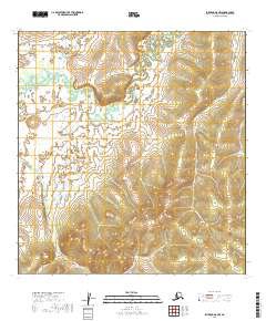
2019 Map of Iditarod A-5 NW
USGS Topo · Published 2019About this map
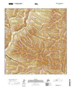
The Iditarod River meanders through the northwestern corner of this remote Alaskan interior landscape, a region defined by extensive wetlands and isolated topographic rises. The most prominent relief in the area is Haystack Butte, which stands as a clear landmark in the southeastern quadrant near the headwaters of Glacier Cr. The drainage patterns here are complex, with the Iditarod River fed by various tributaries like Smith Cr and Timber Cr, forming a network of intricate waterways across the Yukon-Koyukuk region. This 2019 survey reflects a landscape largely untouched by permanent settlement or infrastructure, preserving the natural hydrological character of the river basin as it appeared in the early 21st century. The map serves as a vital record for understanding the original drainage paths and unnamed ridges of this interior wilderness.
Find a feature on this map
10 named features on this map. Tap any name to fly to it.
Don’t see what you’re looking for? This feature index may not catch every label — zoom into the map to look around manually.
Map Details
Editions of this 2019 Iditarod A-5 NW Map
This is the sole edition of this map. No revisions or reprints were ever made.
Other maps of this area

1951 · Iditarod
USGS Topo · 1:250,000

1954 · Iditarod A-6
USGS Topo · 1:63,360

1954 · Iditarod A-5
USGS Topo · 1:63,360

1954 · Iditarod B-5
USGS Topo · 1:63,360
1954 · Iditarod B-6
USGS Topo · 1:63,360

1956 · Iditarod
USGS Topo · 1:250,000
2019 · Iditarod A-5 SW
USGS Topo · 1:25,000
2019 · Iditarod B-5 SE
USGS Topo · 1:25,000
2019 · Iditarod A-5 SE
USGS Topo · 1:25,000
2019 · Iditarod B-5 SW
USGS Topo · 1:25,000