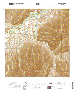
2019 Map of Iditarod A-6 SE
USGS Topo · Published 2019About this map
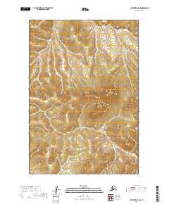
Iditarod River meanders through the northern reaches of this landscape, marking a remote interior region of Alaska defined by its complex drainage network. The terrain is shaped by numerous seasonal and permanent waterways, including Montana Creek and Return Cr, which flow through the upland topography. The boundary between the Yukon-Koyukuk Census Area and Bethel Census Area bisects the sheet, indicating the administrative division of this wilderness. Smaller tributaries like Little Cr and Small Cr provide detailed insights into the watershed patterns of the Yukon-Koyukuk region. This survey highlights the intersection of several township and range lines, providing a precise grid for an area primarily characterized by its natural features rather than human settlement.
Find a feature on this map
15 named features on this map. Tap any name to fly to it.
Don’t see what you’re looking for? This feature index may not catch every label — zoom into the map to look around manually.
Map Details
Editions of this 2019 Iditarod A-6 SE Map
This is the sole edition of this map. No revisions or reprints were ever made.
Other maps of this area

1950 · Sleetmute
USGS Topo · 1:250,000

1951 · Iditarod
USGS Topo · 1:250,000
1954 · Sleetmute D-8
USGS Topo · 1:63,360
1954 · Sleetmute D-7
USGS Topo · 1:63,360

1954 · Iditarod A-6
USGS Topo · 1:63,360

1954 · Iditarod A-5
USGS Topo · 1:63,360

1954 · Sleetmute
USGS Topo · 1:250,000

1956 · Iditarod
USGS Topo · 1:250,000
2019 · Sleetmute D-8 NE
USGS Topo · 1:25,000
2019 · Sleetmute D-7 NW
USGS Topo · 1:25,000