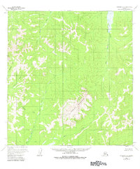
1954 Map of Iditarod B-2
USGS Topo · Published 1983About this map
Granite Mountain dominates the central landscape of this interior Alaska survey, serving as the topographical anchor for a complex network of drainage basins. The area is defined by the headwaters of the Kuskokwim River system, with the Big Waldren Fork and Little Waldren Fork carving paths through the northern half of the quadrangle. To the south, the terrain feeds into the East Fork George River via tributaries like Moose Creek. The mapping reveals a wilderness devoid of established roads or permanent settlements in the mid-1950s, where movement was dictated entirely by watercourses such as Granite Creek and Munther Creek. This document captures the region in its raw, unsurveyed state, with land lines predetermined by the Bureau of Land Management but not yet marked on the ground.
Find a feature on this map
9 named features on this map. Tap any name to fly to it.
Don’t see what you’re looking for? This feature index may not catch every label — zoom into the map to look around manually.
Map Details
Editions of this 1954 Iditarod B-2 Map
3 editions found
Other maps of this area

1951 · Iditarod
USGS Topo · 1:250,000

1954 · Iditarod B-1
USGS Topo · 1:63,360

1954 · Iditarod A-1
USGS Topo · 1:63,360

1954 · Iditarod B-2
USGS Topo · 1:63,360

1954 · Iditarod A-3
USGS Topo · 1:63,360

1954 · Iditarod A-2
USGS Topo · 1:63,360

1954 · Iditarod C-3
USGS Topo · 1:63,360

1954 · Iditarod B-3
USGS Topo · 1:63,360

1954 · Iditarod C-2
USGS Topo · 1:63,360
1956 · Iditarod C-1
USGS Topo · 1:63,360